Sunday, August 16, 2015

Jefferson

In Twin Bridges yesterday and fishing the Jefferson River. They have a restriction on fishing between 2:00 pm and midnight, so I was on the river by 6:00 am. The pelicans and Sandhills didn't appreciate the early intrusion. 
A few moments later on two does with fawns strolled across the river. 

I caught a few whitefish of less than notable size but it was fun trying to match the insects they were feeding on.  

After that I went up to West Yellowstone. Still very smokey, this was the Madison inside the park. 

Didn't fish but I'm formulating a plan to fish in the park after I leave Bozeman. 

I don't know what year they had the fires in the park, but there was lots of recovering spots with little or no trees, and the new growth looked to be about 10-15 years old. 

Back down the Gallatin River to Bozeman. Looks like I'll fish this on my first day out of town and then hopefully find a place to camp in the park. That is the only way I'll be able to fish early because they don't open the gates until 8:00 am. 
This is the Gallatin 40 miles north of West Yellowstone. 

Found a nice RV park in Bozeman
Actually, that is the setting sun in the smokey west. 

Hung out today. No fishing or driving. Did laundry and waited for Jake and Bill. 

Denver by the end of the week at least. 


Friday, August 14, 2015

Back in the USSA

As the Beatles would put it. 

Today I ended up in Twin Bridges, MT. But first lets back up to where I left off in Babine Lake. 
This is one of two counting stations where they visually count the Reds getting past the gate from Babine Lake to the mouth of the Fulton river. Above this point are two huge man made spawning beds. The first, constructed in 1965, has about 1/4 mile of switch back beds that they divert the Fulton River through for the spawning season. After the season, when the smolts have moved out to the lake, they shut off the flow and rake in with bulldozers to prevent alge growth and make it perfect for next season. There is a newer, bigger section just above the gate with concrete bottom covered with perfect sized river rock for spawning. Here's a link to a PDF complete with pictures (since I have none):
http://www.stateofthesalmon.org/pdfs/Riddel_1_FINAL.pdf

Anyway, after the escapement is assured, they shut the gates. This traps a ton of Salmon in Babine Lake so........ They put two seiners in the lake to clear them out. Again pictures in the PDF. 

They have improved the run from less than a million to over three million. This is the run that has to get past Prince Rupert to get here. 

On to the Jasper Provincial Pakr via the Stellako River which runs from Francois River to Fraser Lake, a short but nice river. 


I caught one small brown, not photo worthy, so I did a short line release. 
Right before Jasper Park was this mountain. 
Mt Robson, complete with a glacier running from the peak to the right.

Then the smoke began. The Rockies were all in smoke from fires all the way into Montana. I finally saw the last one just north of Lincoln, MT. Photos of that later. First, here are a few of the mountains on the East side of the valley from Jasper to Banff. All the glaciers (and there were tons) were on the West side of the valley. 
Moose lake, crystal clear in foreground, blue green from glacial silt in deeper parts. 

East side mountains. 
Glacial flow right up to roadside 

Columbia ice fields

I thought of Troy DeJean and free climbing


And then there were these overpasses
Finally dawned on me, why they looked so different. They are not for people. The road south out of Jasper has game fence on both sides and these overpasses to facilitate east-west travel for the wild life. I will say, I didn't see any road kill in these parts.

Went to drive through the Glacier National Park west of Great Falls but smoke was bad. I ended up in Lincoln, MT and saw the last of the fires. From here south, no smoke 

Basically, I can't stand the heat. Been pushing 100 since I crossed the border. Lincoln is right near the continental divide (around 5100 ft) so a little better.

Too hot for me in Craig, MT so I mover on to Twin Bridges, MT. Still hot but forecasted cooler tomorrow. The water upstream from Craig is low and that combined with the heat has resulted in a fishing ban from 2:00 PM to midnight on most streams. Going to try my luck early tomorrow. I've been spoiled with most starts around the crack of 9:00 or 10:00. Hope to try the Gallatin River after my early start. 

Planning on Bozeman by the 16th to see Bill and Jake before heading for Denver and a rest. 

Mileage total passed 6500 today. 

Stay cool. 

Tuesday, August 11, 2015

Canada

Ferry ride was all I expected. Fantastic scenery, lots of interesting people and relaxing. 
I spent the night in the ferry parking lot and we loaded up first thing in the morning. 
The Matanuska returning from a five hour turn around to Skagway. 
The loading ramp. 

One guy got to back in; took him a few shots. 

First stop, Jueanu and the Breeze Inn for the mandatory fritter. 
Three bucks. I've paid that much for one half this size. I had to get more than one for the rest of the trip. Finished off the last of them yesterday. 

We docked at Prince Rupert at 3:00 AM and the library didn't open until 11:00 so I pressed on to Babine lake where the Fulton river flows in. They were getting a red run from Prince Rupert and they were trolling for them in the lake. 
Here's the rig that they were hitting. A huge flasher with about two feet of leader to a bare hook with three beads in front of it. Wonder if that would work in the back waters or the mouth of the Kenai?

Rained right after I set up so I rigged this the next day to help things air out with showers still expected. 
Worked well, but it's going to be a real pain lugging the picnic table around. 

Cell coverage is not good for Verizon up here but the visitor centers have lightning fast Wifi. Libraries, not always so fast. The library at Babine lake had fiber optic Wifi and were still waiting for their first cell phone tower. 

More on the Babine Lake reds later; now it's on to Jasper Park. 

Getting warmer as I move east. 

Stay cool where you are. 


Wednesday, August 5, 2015

In Haines

LFinally got out of Homer and made it to Tok just before midnight Monday. Total trip miles leaving Homer were 3700 ( starting at Bend ). 

Had to make a note for future travels: 
When leaving a large city ( Anchorage in this case ), try to not do it at rush hour. 

Nearing sunset I found myself 21 miles east of Gakona looking at the Wrangle mountains. 
They are, left to right: Sandiford 16,237 ft; Wrangle 14,163 ft; and Blackburn 16,390 ft. I didn't know that Cody had a mountain named after him. I shouldn't be surprised. 

The next day was Tok to Haines. The road was brutal from Beaver Creek to Burwash but got better by Kulane Lake. 

Trip log 4530 miles. Refuel at Haines Junction and head south. 
First on the "stop and see" list was the rock glacier. 
I'd never heard of rock glaciers but apparently the ice melts back at a stage when there are lots of small rocks in the moraine. Most of the glacier is gone leaving a valley of rocks. 


Many thanks to the guys (and apparently a few gals) that built the path in 1978. 


This is the view from the rocks. 

A little further down the road were the guardians. 
Two of the barest mountains I've seen. I believe they go above the lichen line.  Then I realized that the elevation where I'm standing is only 900 meters. 

The next valley, just a few miles down the road, has dozens of hanging glaciers. 

The road continues down through AK Customs and joins the river running down that valley. 
Quite a flow. 

A few more miles and I am in Haines. 
Carnival in town. 

I check out what must be one of the shortest rivers in Alaska. The Chilkoot. 
It runs from the top of the bay about two miles to the lake. 
But it has plenty of bears. This sow was feeding her two cubs (they are just right of the rear view mirror) and people were crowding her for photos. 

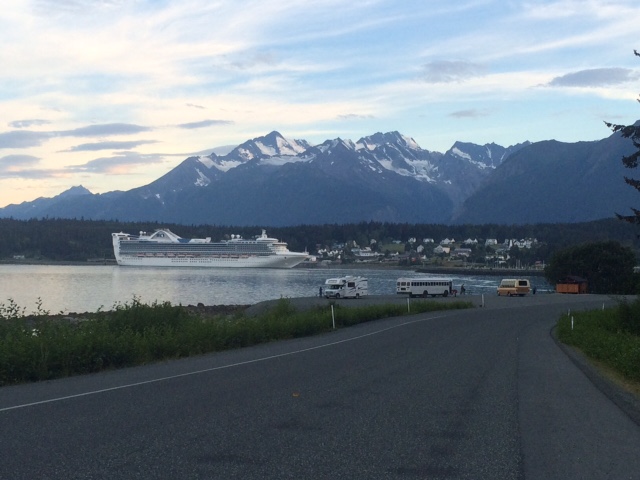
By the time I got back to town a new cruise ship was in. 

All in all, Haines is a pretty cool place and the road down from the AK Highway is fantastic!

Looks like rain tomorrow. Must be in the pan handle. 

Stay cool. 


Sunday, August 2, 2015

Back to the Road

Leaving Homer tomorrow, hoping to make Tok the first night out. I imagine cell and wireless coverage will be sporadic for a while. 

Went for a walk on the inlet side of the spit today. 
There were tide pools a plenty. 

I might have discovered the ruins of an ancient mech ciliviaztion.
That definitely looks like a cyborg spine. 

There are the remains of an old dock, I think it was for a cannery. 
The eagle didn't seem too concerned. 

This scene reminded me of a assignment in high school photography class. We were supposed to find and photograph an example of texture. 


On the other side out the spit there were Fireweed that were topping out
While the ones way up on Ohlson Mountain are just beginning their prime. 

Found some charcoal like drift wood. It is all over this side of the spit. 

The fireman/pyro in me had to know if they would burn well. Exhaustive tests in the Worsfold fire pit were inconclusive. Some did, some didn't. 

Weather has been better that perfect. Alaska can do that sometimes. 

Travel safe, see you on the other side.